-

arif wicaksono
Saat ini bekerja sebagai Analis Kebijakan Muda pada Bappeda Kota Bogor. Pendidikan terakhir S3 Program Studi Geoinformatics dari Suranaree University of Technology, Thailand. Minat utama penelitian pada analisis lokasi menggunakan Sistem Informasi Geografis dengan metode Fuzzy dan multi kriteria.
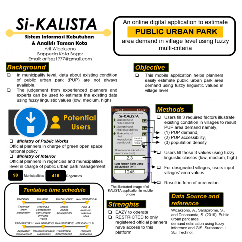
Si KALISTA - An online digital application to estimate public urban park area demand in village level using fuzzy multi-criteria
June 03, 2020In municipality level, data about existing condition of public urban park (PUP) are not always available. This creates uneasy condition when planners have to estimate the PUP demand in villages. Based on previous study (Wicaksono, Sarapirome and Dasananda, 2019), the relationship among PUP accessibility, demand and population density in form of fuzzy liguistic values can be processed to generate required PUP area in village level. Since the judgement from experienced planners and experts can be used to estimate the existing data using fuzzy linguistic values (low, medium, high), therefore it can be input into a digital platform to obtain PUP area in village level. This mobile application helps planners easily estimate public urban park area demand using fuzzy linguistic values in village level. Users fill 3 required factors illustrate existing condition in villages to result PUP area demand namely, PUP demand, PUP accessibility and population density in form of fuzzy linguistic classes (low, medium, high). For designated villages, users input villages’ area values, and the application will generate PUP area information.
The potential users of this application are the planners from Ministry of Public Works in charge of green open space national policy. This application can also be used by the officials from Ministry of Interior especially for planners from all regencies and municipalities dealing with PUP planning and management. The strenghts of this application are easy to operate and it will be restricted only to registered planners.
Data source and Reference:
Wicaksono, A., Sarapirome, S., and Dasananda, S. (2019). Public urban park area demand estimation using fuzzy inference and GIS. Suranaree J. Sci. Technol., Available from: http://ird.sut.ac.th/e-journal/Journal/pdf/180301373.pdf
